SEMANTIC TOOLS FOR CARBON REDUCTION IN URBAN PLANNINGCo-funded by the European Commission within the 7th Framework ProgrammeNewcastle, United kingdomThe aim of the SEMANCO project is to reduce CO2 emissions byintegrating the analysis of CO2 production in our neighbourhoods,cities and regions. The tools and methods developed in the projectwill be used to inform decisions about the energy performance andcost effectiveness of different design and planning alternatives by: •Classifying buildings for energy analysis •Visualising urban energy consumption •Assessing different methods of reducing CO2 emissions •Predicting future energy demand •Providing appropriate energy indicators for local authorities In the Riverside Dean pilot these tools will be demonstrated at the following geographical scales Map Neighbourhood scaleAt the neighbourhood/municipal level pilot study will focus on the second phase of the redevelopmentof Riverside Dean (formally known as Cruddas Park) which is supported by Newcastle City Council,Bridging Newcastle Gateshead, and New Deal for Communities and Your Homes Newcastle. Map Municipal Riverside DeneA major part of the first phase of the redevelopment of the Riverside Dean involved therefurbishment and internal remodelling of three of the five pre-existing residential housing blocks. Acore aim of this large scale redevelopment on Tyneside was to bring existing 1960s design housingup to and beyond 'Decent Homes Standards', whilst also aiming to reduce carbon emissions andlevels of fuel poverty. In addition to further housing regeneration and renewal, the second phase of the redevelopment willsupport the critical regeneration of the Cruddas Park Shopping Centre, which has the potential to bea powerful social and commercial focus and will provide a new revitalised community andcommercial focal point for the area. Furthermore, the current master-planning includes thedevelopment of a new commercial unit on the southern edge of the site. This will provideopportunities for local employment and involvement, as well as presenting a high-profile moderndevelopment aspect onto the main road (Scotswood Road) providing access to the site. Finally, it isproposed Cruddas Park will be re-landscaped to provide an exceptionally high quality of localenvironment that meets the diverse needs of the community. As it stands the green areas andstreets are poorly defined and the estate lacks a cohesive urban identity. But there are solutions toall of these social, economic and environmental challenges which will be explored further as part ofour study. The findings from this will be linked to analysis of energy use across the whole of the Cityof Newcastle upon Tyne. Visit the blog
 SEMANTIC TOOLS FOR CARBON REDUCTION IN URBAN PLANNING
 Co-funded by the European Commission within the 7th Framework Programme
Newcastle, United kingdom
The aim of the SEMANCO project is to reduce CO2 emissions by
Co-funded by the European Commission within the 7th Framework Programme
Newcastle, United kingdom
The aim of the SEMANCO project is to reduce CO2 emissions by integrating the analysis of CO2 production in our neighbourhoods,
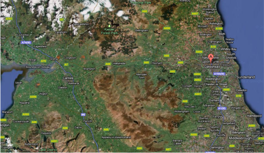 In the Riverside Dean pilot these tools will be demonstrated at the following geographical scales
  Map Neighbourhood scale
At the neighbourhood/municipal level pilot study will focus on the second phase of the redevelopment
Map Neighbourhood scale
At the neighbourhood/municipal level pilot study will focus on the second phase of the redevelopment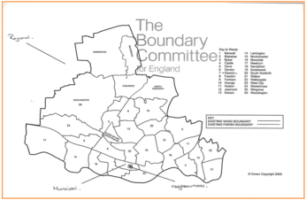
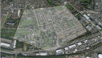
 Map Municipal Riverside Dene
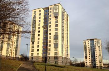 A major part of the first phase of the redevelopment of the Riverside Dean involved the


 Visit the blog